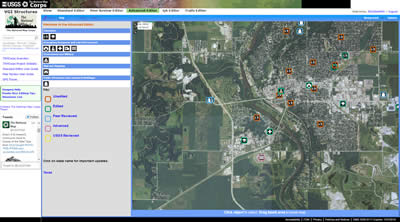
The National Map Advanced Editor.

An official website of the United States government
The .gov means it’s official.
Federal government websites always use a .gov or .mil domain. Before sharing sensitive information online, make sure you’re on a .gov or .mil site by inspecting your browser’s address (or “location”) bar.
This site is also protected by an SSL (Secure Sockets Layer) certificate that’s been signed by the U.S. government. The https:// means all transmitted data is encrypted — in other words, any information or browsing history that you provide is transmitted securely.
The National Map Advanced Editor.
Over the past two decades, the U.S. Geological Survey has sponsored various kinds of crowdsourcing projects for collecting map data. Volunteers in the Earth Science Corps, for example, annotated paper topographic maps; in another project, participants collected data points using handheld GPS devices; and in 2006, volunteers used Web-based technology to input data. In 2012, the USGS launched The National Map Corps to meet the need for current, high-quality, nationwide data on schools and other buildings.
Download this case study (PDF, 137KB)
Website: The National Map Corps
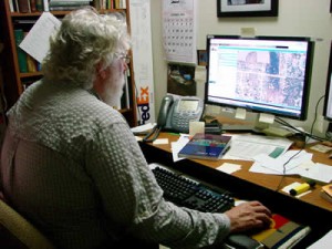
A National Map Corps volunteer at the computer. Photo credit: U.S. Geological Survey.
TNMCorps volunteers are successfully editing 10 different types of structures in all 50 States, including schools, hospitals, post offices, police stations and other important public buildings. Requirements to become a TNMCorps volunteer are simple: computer access to the Internet, an email address, a self-identified username and a willingness to learn and explore new places.
After an easy registration process, volunteers begin editing using a Web-based mapping platform. Using National Agricultural Imagery Program imagery or The National Map as their primary base layers, volunteers collect and improve data on structures by adding new features, removing obsolete points and correcting existing data. Fellow volunteers peer-review the edits, which are incorporated into The National Map and ultimately into US Topo maps.
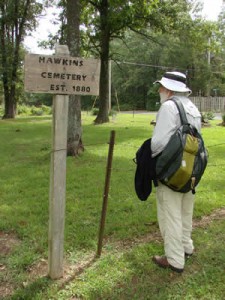
A volunteer verifies a cemetery site. Photo credit: U.S. Geological Survey.
Challenges include recruiting, engaging and motivating volunteers. TNMCorps meets the challenges by using gamification techniques and a mixture of traditional and social media. Gamification includes easy sign up, virtual recognition badges, friending, map challenges, social media interaction and a tiered editing approach, techniques that have all proven successful. TNMCorps continues to see substantial increases in the number of volunteers and volunteer contributions to The National Map.
Crowdsourcing sometimes raises concerns about data quality. In 2012, an analysis of data for the state of Colorado showed that volunteer involvement improved positional and attribute accuracy for all types of structures while reducing errors of commission. In 2014, a data quality study at the national level had similar results. Both studies showed that volunteer edits improve baseline data on structures; that peer review by fellow volunteers along with edits by vetted advanced editors improve the data even further; and that sample-based inspection by USGS personnel can effectively monitor these processes.
Nevertheless, some resist accepting data from volunteers, arguing that they aren’t “good enough” to populate national databases. The project is also working through issues related to the lack of a well-established policy regarding government use of crowdsourcing and citizen science. For example, the Paperwork Reduction Act requires the project to obtain approval from the Office of Management and Budget for conducting a “survey,” even though the project really isn’t conducting a survey at all.
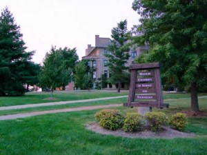
Home of the National Map Corps program. Photo credit: U.S. Geological Survey.
TNMCorps has shown that volunteers can effectively contribute to the quality of data about structures shown on the National Geospatial Program’s National Map and US Topo maps. Project success comes from building on past experience, leveraging existing technology and having the support of key individuals within the sponsoring organization.
Accordingly, TNMCorps has grown to almost 3,000 registered volunteers who, as of July 2015, had contributed over 150,000 edits. TNMCorps has grown by leveraging social media via USGS Facebook and The National Map twitter account, taking advantage of the Volunteer.Gov website, and implementing gamification techniques. TNMCorps offers consistently accurate data about structures; a national study showed that the quality of the structure points edited or confirmed by TNMCorps volunteers is excellent.
The TNMCorps case study illustrates the following steps in the Federal Citizen Science and Crowdsourcing Toolkit:
Elizabeth McCartney
Email: emccartney@usgs.gov