Photo Credit: DoD/SGT Alexis Velez

An official website of the United States government
The .gov means it’s official.
Federal government websites always use a .gov or .mil domain. Before sharing sensitive information online, make sure you’re on a .gov or .mil site by inspecting your browser’s address (or “location”) bar.
This site is also protected by an SSL (Secure Sockets Layer) certificate that’s been signed by the U.S. government. The https:// means all transmitted data is encrypted — in other words, any information or browsing history that you provide is transmitted securely.
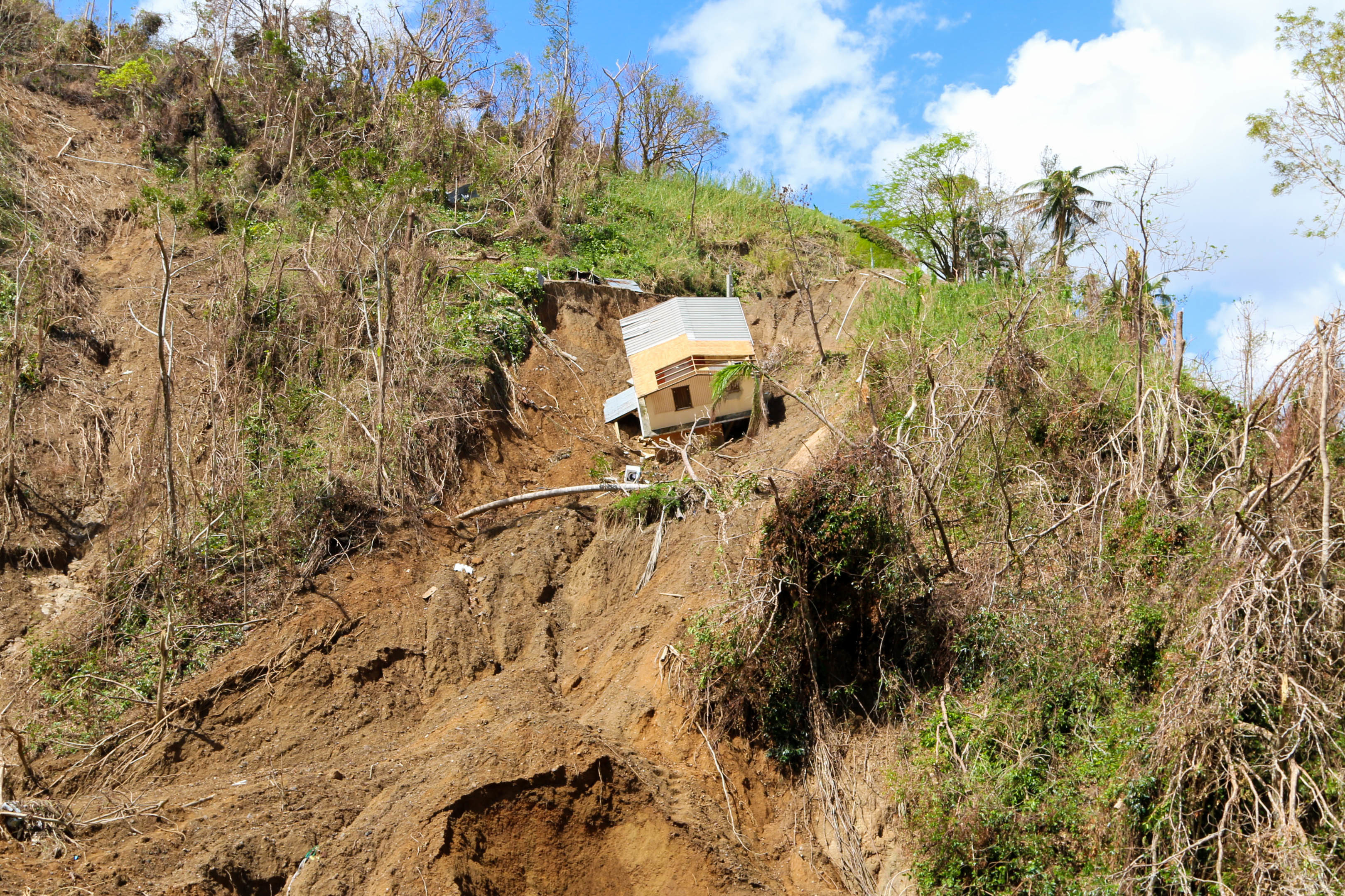
Landslides cause billions of dollars in property damage and thousands of deaths every year worldwide. Scientists here at NASA Goddard Space Flight Center are building a massive open worldwide database for landslide research, and we are calling upon volunteers to contribute!
Photo Credit: DoD/SGT Alexis Velez
Landslide Reporter is part of a larger project launched called the Cooperative Open Online Landslide Repository, or COOLR. The goal of the COOLR project is to create the largest global public online landslide catalog available for everyone to share, download, and analyze landslide information. In order to build a catalog of this size that encompasses the entire Earth’s landslide activity, NASA scientists are turning to crowdsourcing and citizen science.
How it works
Landslide Reporter is the portal that invites citizen scientists like you to volunteer and submit landslides you find in-person or online in local newspapers or databases. In the application, the most important pieces of information scientists are looking for are the location of the landslide, the date the landslide occurred, and the source of the information. Knowing the landslide’s location and date helps match the landslide closely to its causes, like heavy rainfall (i.e. was it raining at the time of the event?) or the type of geology involved (i.e. what type of rock is located at the landslide site?). Furthermore, an accurate description of the landslide’s whereabouts helps scientists validate landslide models to make sure that the models are correctly predicting where landslides are most likely to occur based on a variety of information.
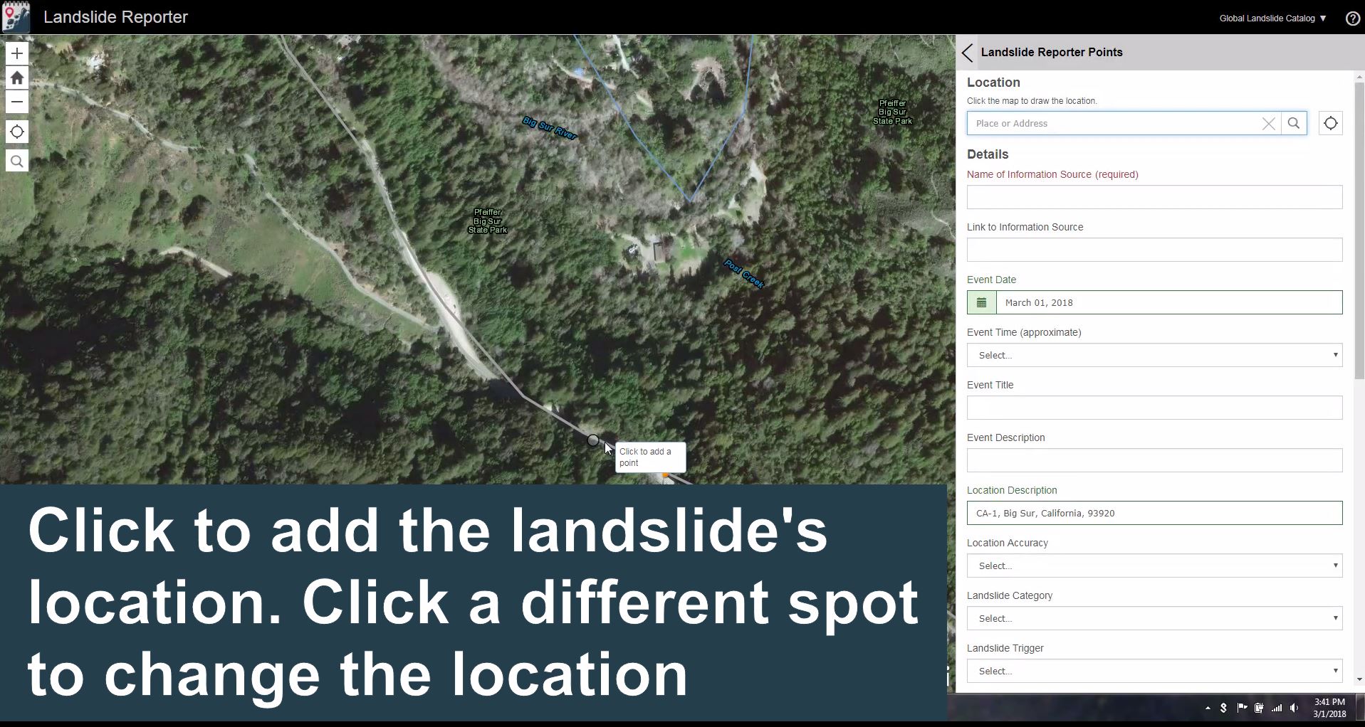
Screenshot of Landslide Reporter from the Landslide Reporter Quick-Start video on the Get Started page.
Citizen scientists can go above and beyond and submit a wide variety of additional details like a description of the event, size of the landslide, landslide trigger, a link to a photo, and more in Landslide Reporter. Once submitted, each landslide report is checked by a NASA scientist on a best-effort basis and, if approved, the landslide event is added to COOLR.
Anyone can look at the landslide data in COOLR with a separate application, Landslide Viewer, and then download the data to use on his or her own. Scientists, policy makers, disaster specialists, and the general public can use the data to improve scientific modeling, conduct emergency response, or just better understand where and when landslides have occurred in their area.
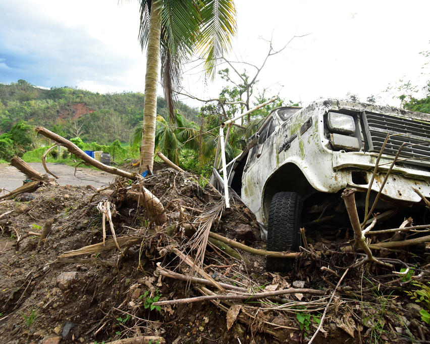
Photo Credit: FEMA/Lee Snyder
Why landslides?
We need continued research on why and how landslides occur to prevent future loss of life and infrastructure. Yet, we have very little open information about where and when landslides occur.
Landslides are hard to track visually because they are often too small to see from space. It’s also difficult to keep complete records of landslides because a single storm or other disturbance could trigger hundreds of landslides at once, making a landslide record hard and time-consuming for a single person to map alone. Additionally, regional landslide databases are rarely shared or open to the greater community, making it difficult to construct a global picture of landslides open to all. COOLR hopes to engage the global landslide community and become the central location for worldwide landslide data sharing.
Why citizen science?
A robust landslide catalog covering the entire world is only made possible with citizen science!
Before COOLR, NASA created and has been maintaining the Global Landslide Catalog (GLC), the largest known open source of rainfall-triggered landslides worldwide. The GLC contains more than 11,000 landslide reports made by our scientists here at Goddard Space Flight Center. However, the manual process of adding new landslide reports solely from our lab is challenging—the process is time-consuming and adds biases to our data. If we sum up all the hours it has taken to compile the GLC since its creation in 2007, it would total 140 days or 84 workweeks (without lunch breaks!) of nonstop landslide reporting. In addition, we are challenged by where and when landslide information is available, which skews our information about how frequently landslides may be occurring and what are the most affected areas.
Citizen science extends our reach with more hands to create a more up-to-date landslide database with as many different sources and as little bias as possible. With your help, we can get a more accurate understanding of the broad reach and impacts of landslides around the world as well as make the general public more aware and educated about landslides as a widespread hazard.
How to get involved
Your data makes a difference! It helps to support decisions that can save lives and property. If you want to begin submitting your own landslide reports, we encourage you to check out the Get Started page of our website, landslides.nasa.gov. Use the how-to guides and videos to learn how to use Landslide Reporter and make high-quality reports. We look forward to seeing your submissions!